PUBLIC SPACE PROPOSAL: can the rising tide lift all boats?
How to make NYC's Rockaway Peninsula a climate change museum worth going to.
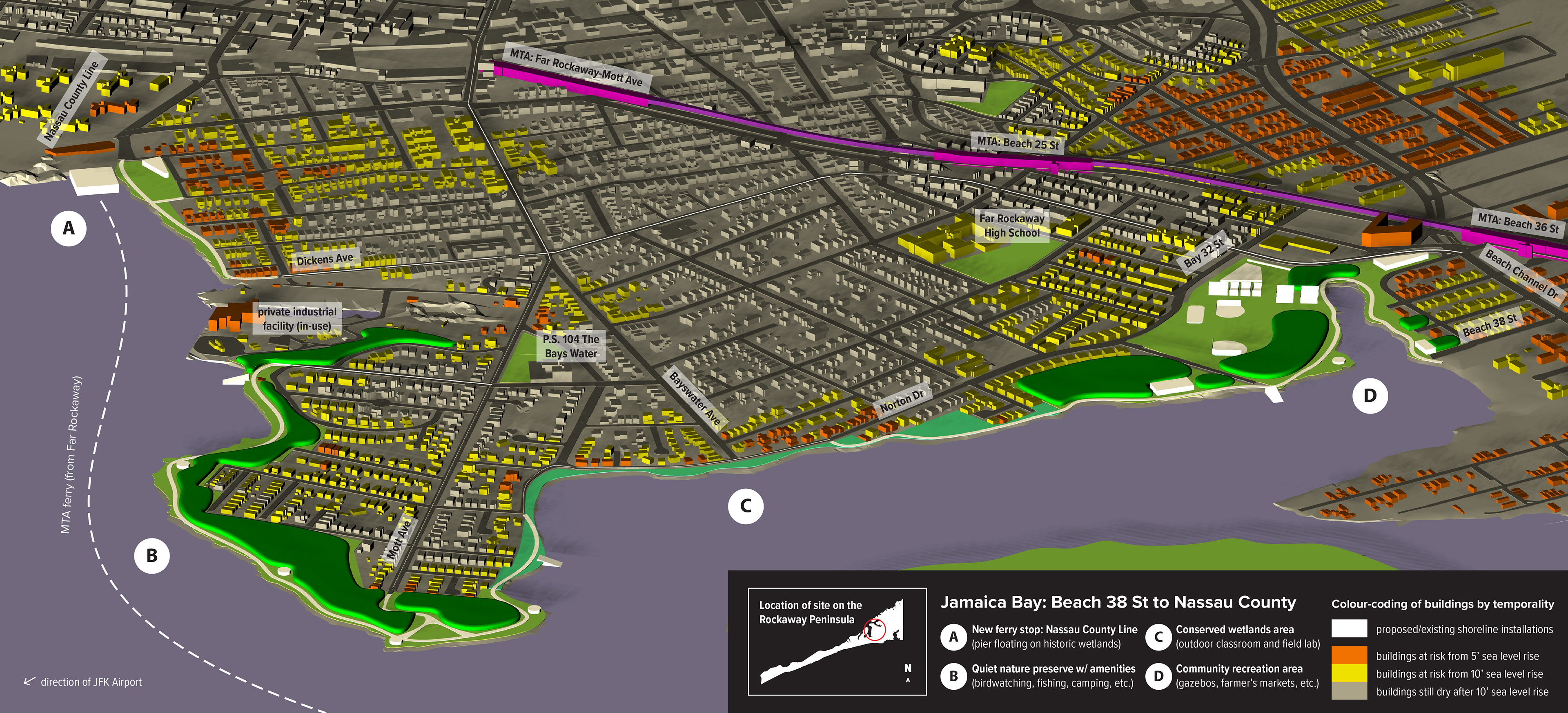
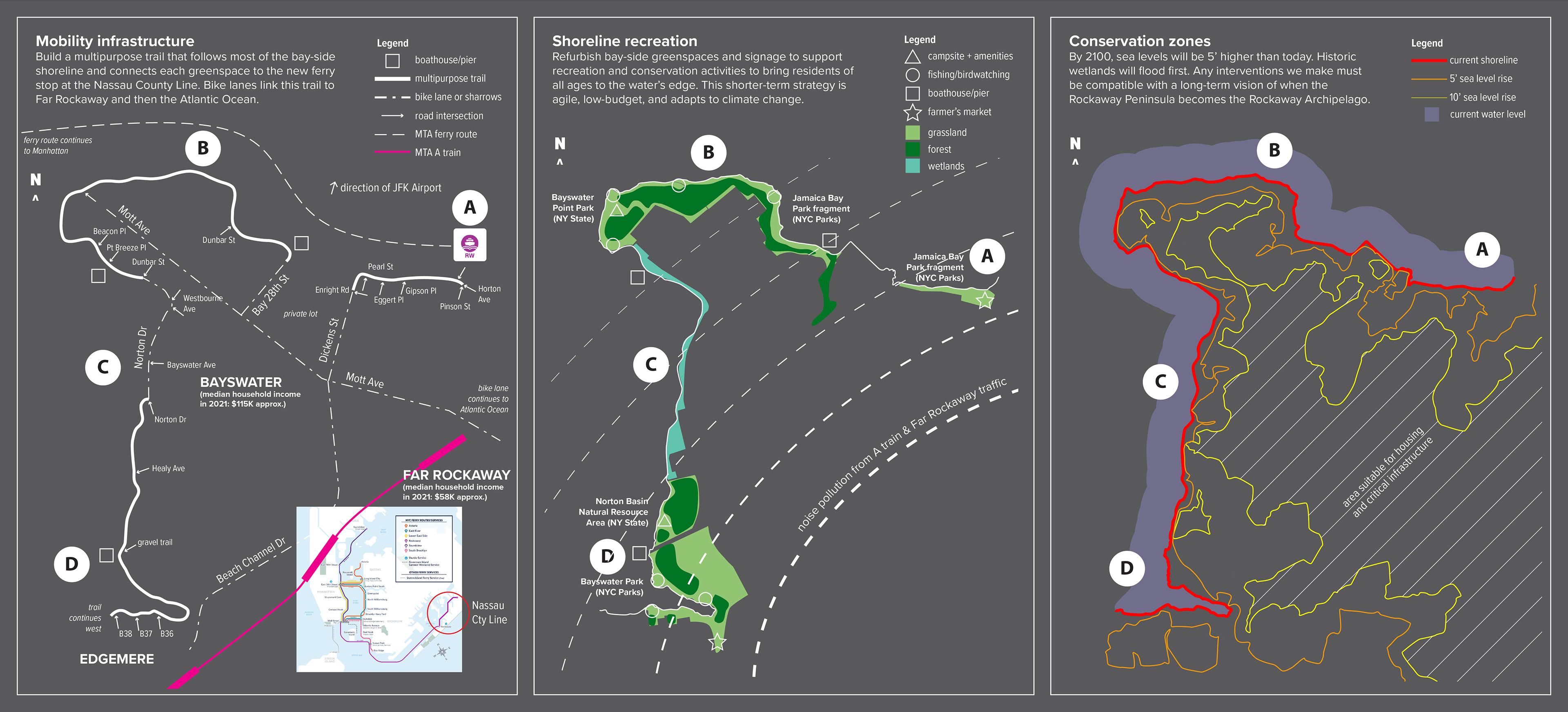
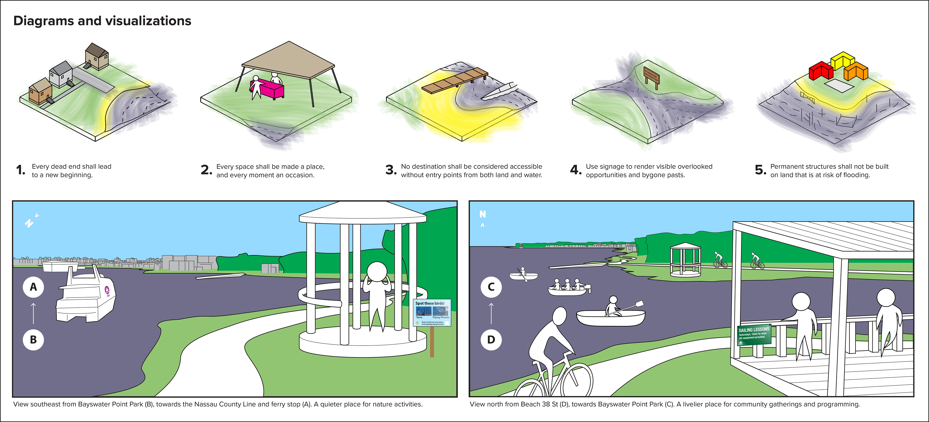
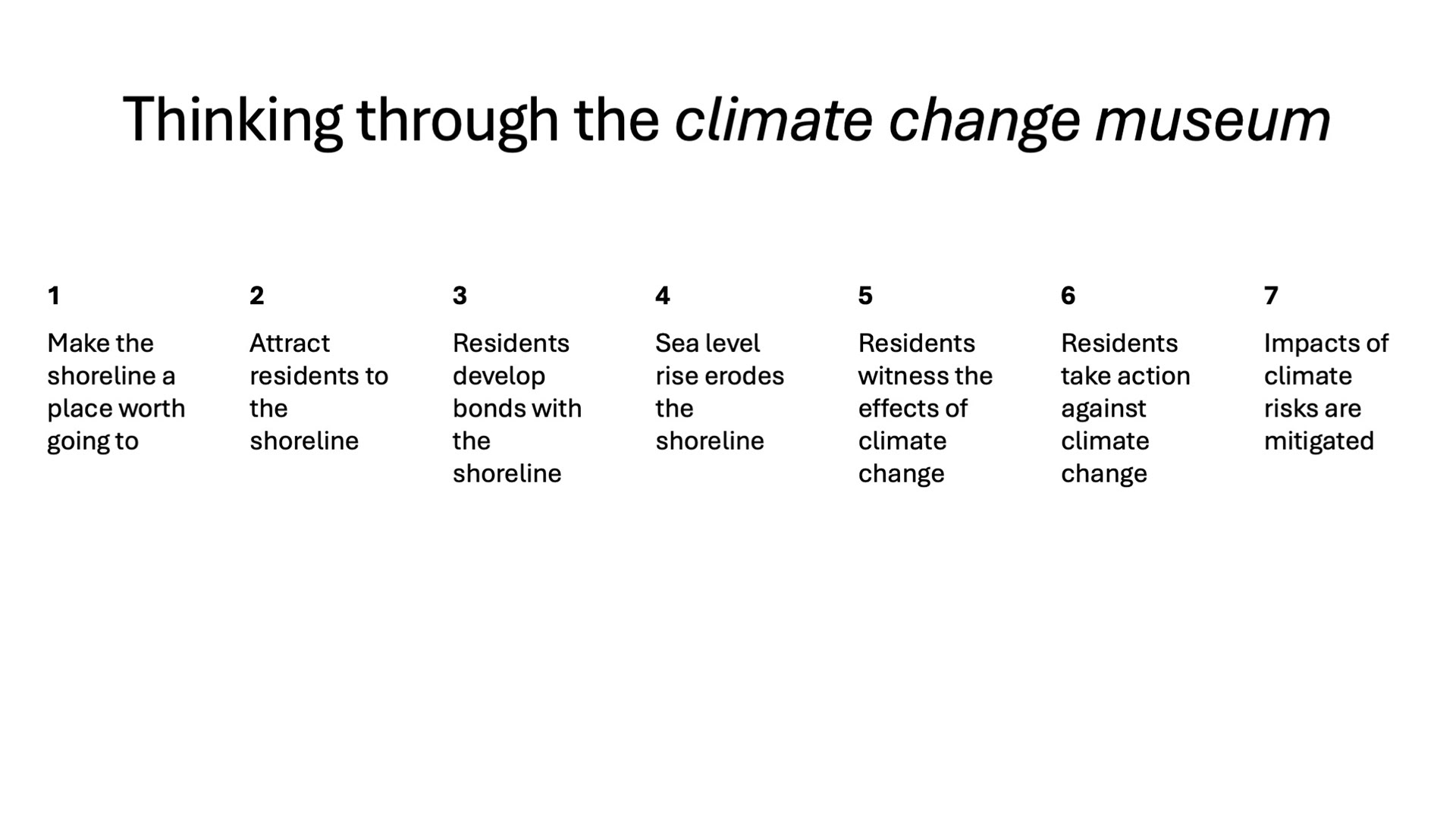
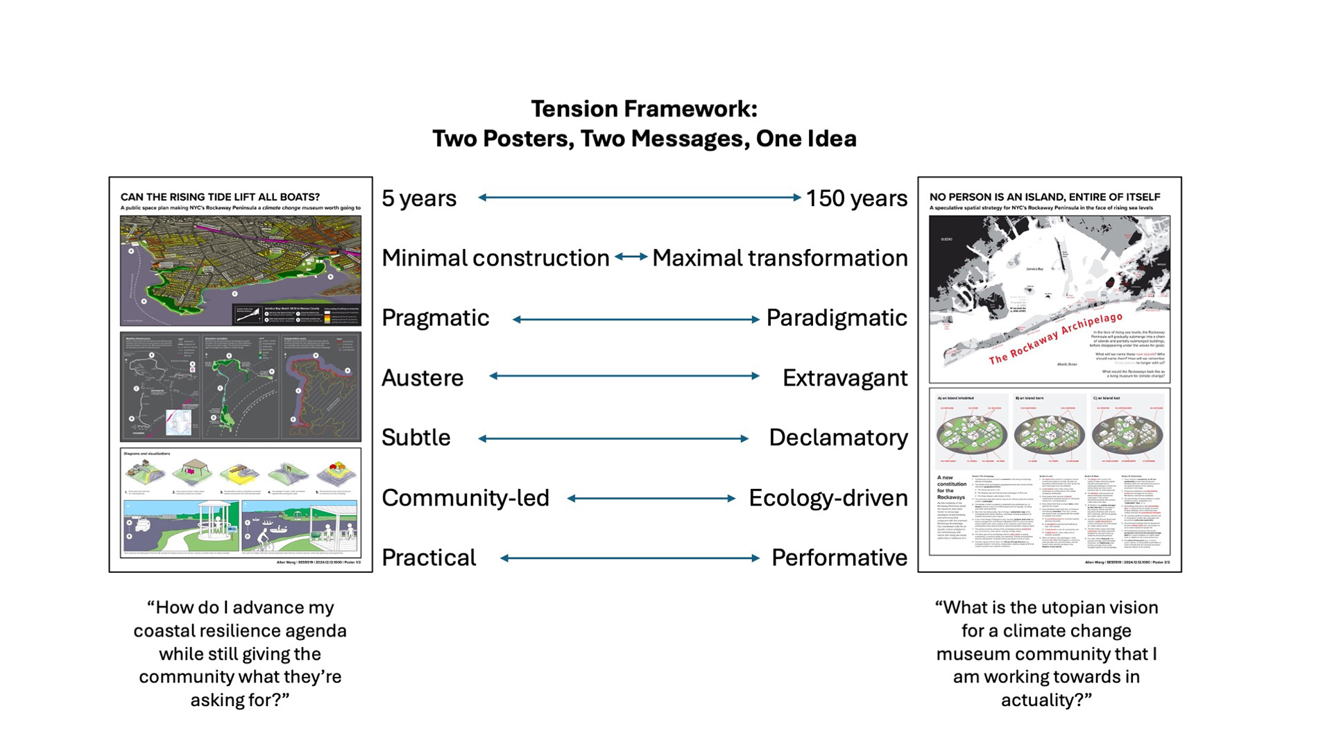
This public space proposal defines short-term, pragmatic interventions around mobility, recreation, and conservation to break down barriers (both physical and relational) between the local community and the Jamaica Bay-side shoreline. By connecting residents to the water's edge, the proposal affirms the inseparability of residents and ecosystems while transforming the day-to-day impacts of sea level rise into lived experiences.
SPECULATIVE SPATIAL STRATEGY: no person is an island, entire of itself
A new constitution for NYC's Rockaway Peninsula in the face of rising sea levels.
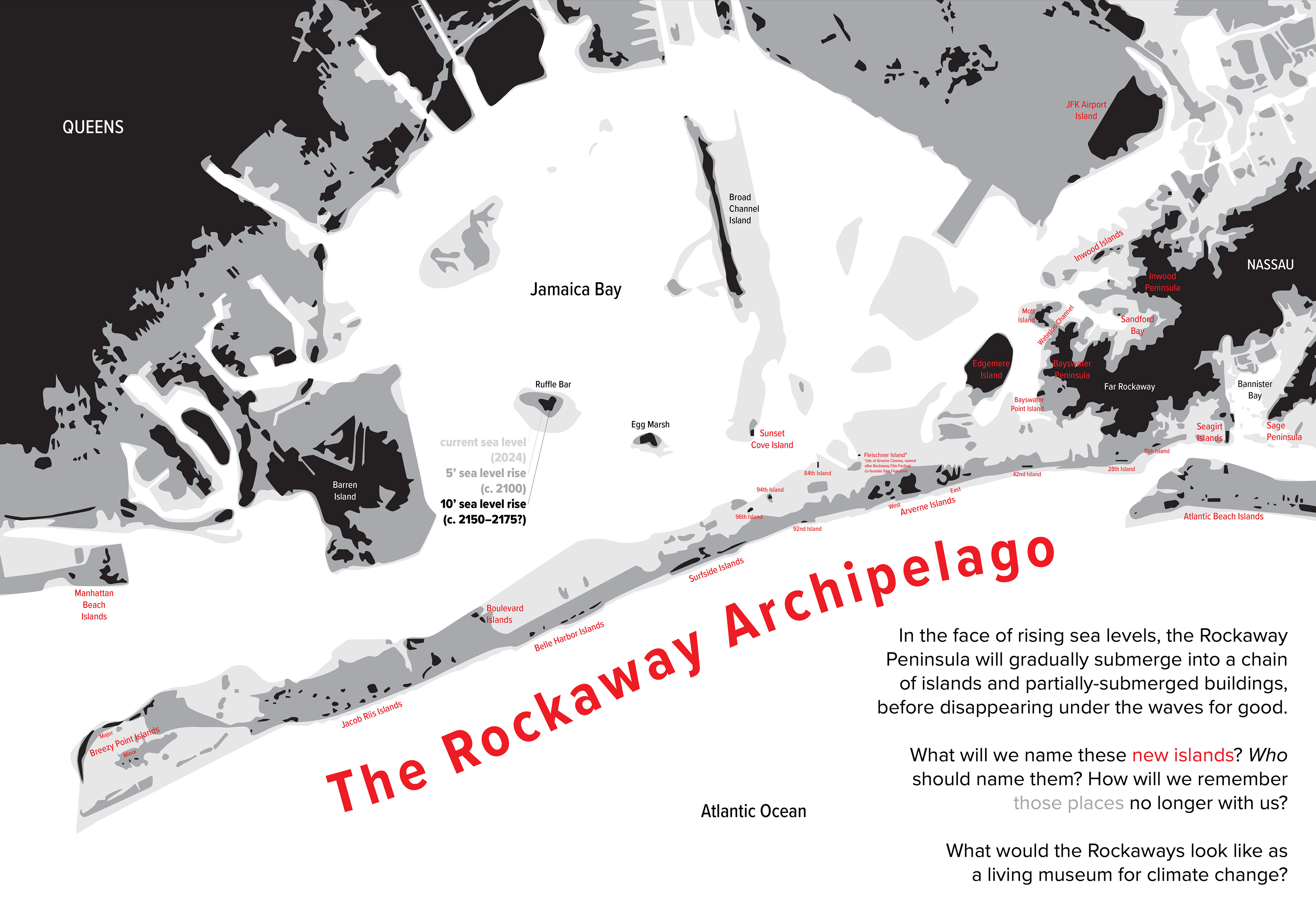
In the face of rising sea levels, the Rockaway Peninsula will gradually submerge into a chain of islands before disappearing under the waves for good. Targeting a 150-year time horizon, this proposal explores the society that will inhabit the future Rockaway Archipelago as defined in a written constitution (inspired by Jane Wolff's Bay Lexicon (2022) and Michael Sorkin's Local Code: The Constitution of a City at 42° N Latitude (1992)). Could it become a living museum for climate change tourism?
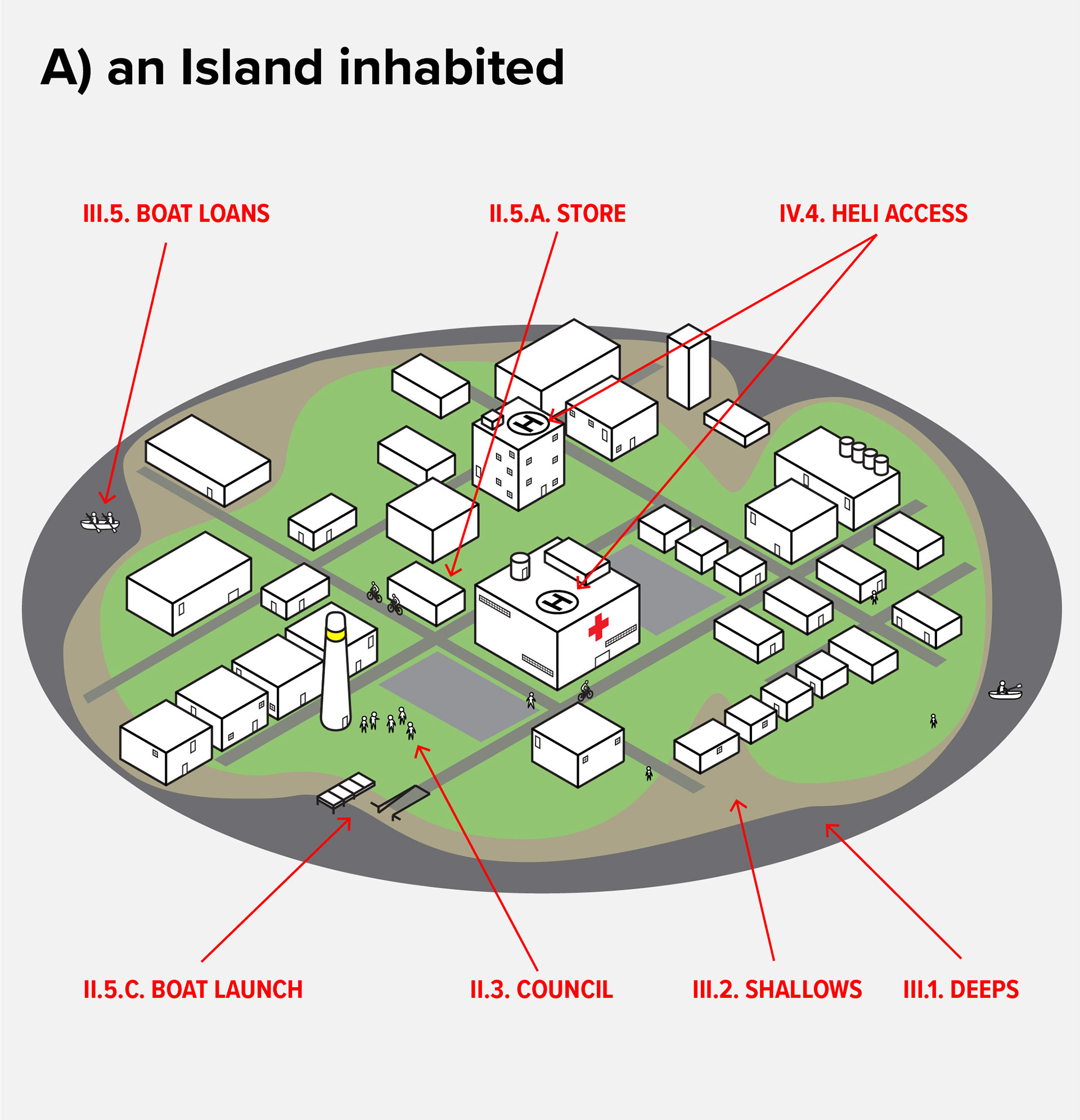
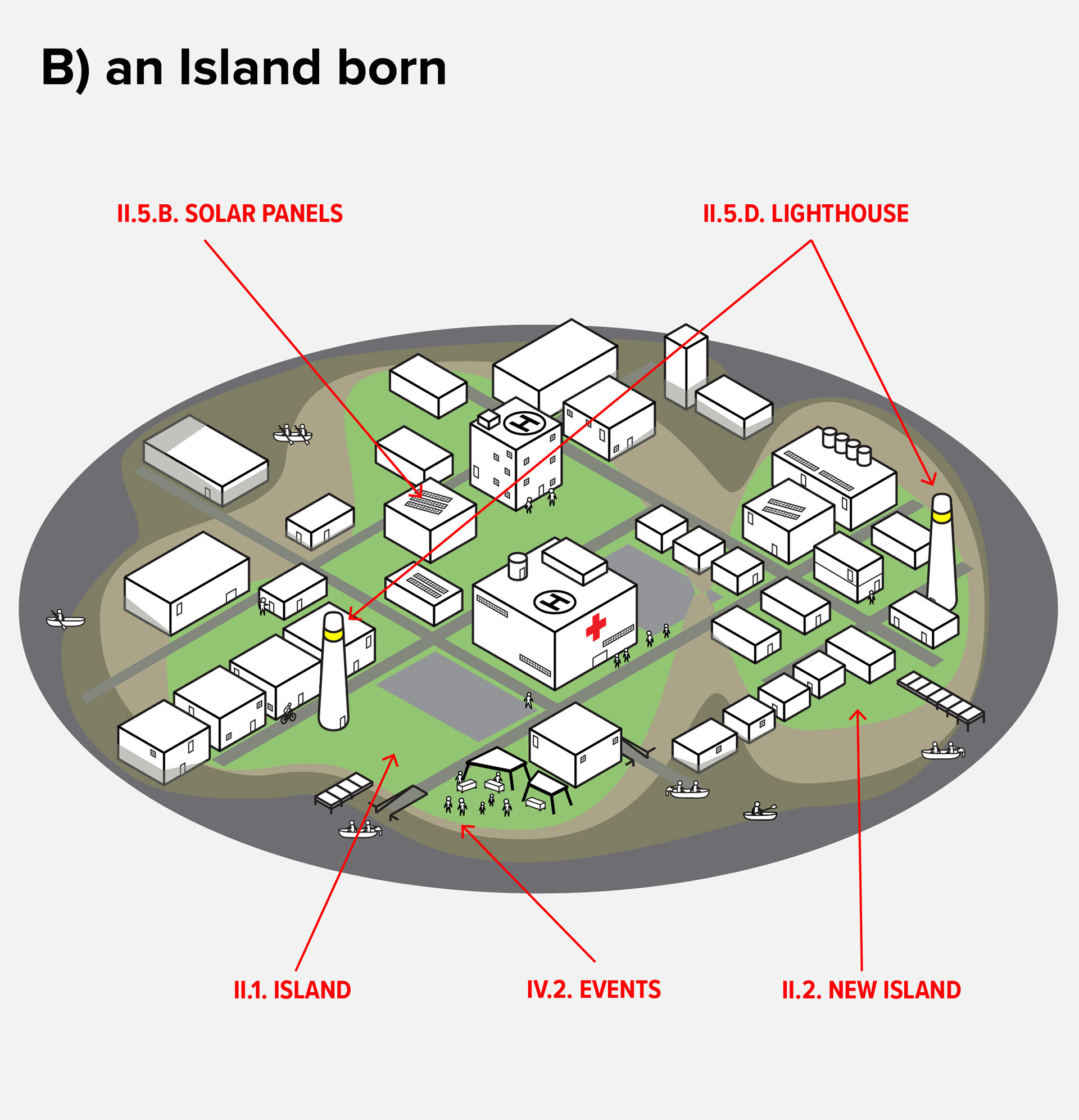
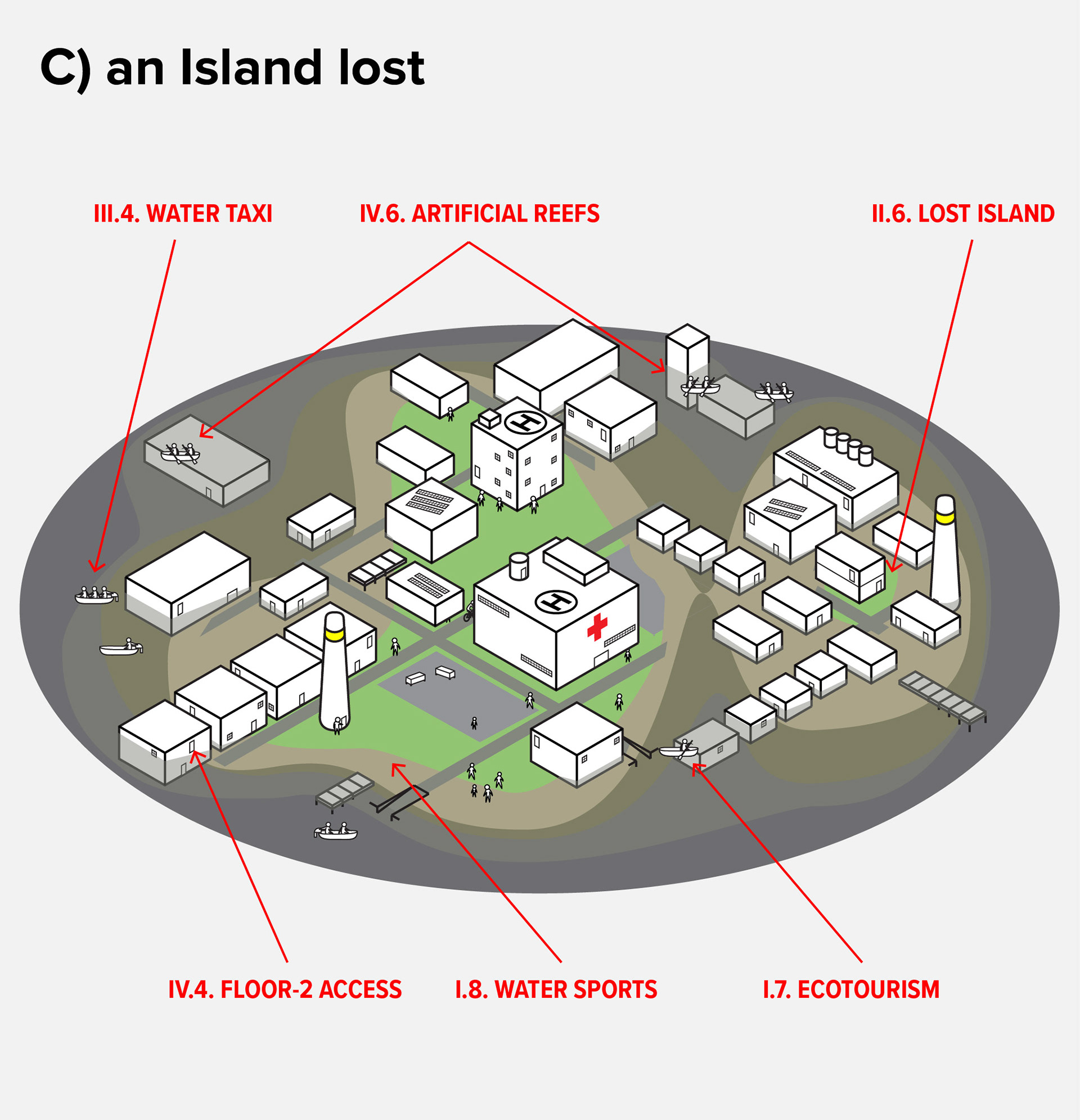
A NEW CONSTITUTION FOR THE ROCKAWAYS
We the residents of the Rockaway Peninsula adopt the elements described herein to encourage paradigms of placemaking and land ownership congruent with the eventual Rockaway Archipelago. Our constitution calls for an aquatic culture adapted to live harmoniously with nature and rising sea levels, rather than in defiance of it. (Red text indicates items pictured in the three diagrams.)
Section I: The Archipelago
I.1. The Rockaway Peninsula shall be renamed the Rockaway Archipelago, effective immediately.
I.2. The entirety of the Archipelago’s geographical area shall consist of three interwoven geographical forms:
I.2.A. The Islands (dry land; cf. II.1.),
I.2.B. The Shallows (dry land that becomes submerged; cf. III.2.), and
I.2.C. The Deeps (deeper water bodies; cf. III.1.).
I.3. The sea level at high tide shall be used as the reference point for whether a place is submerged.
I.4. The decade in which a property is projected to be submerged (i.e., its lifespan) shall be noted on all official paperwork and signage, including real estate advertisements.
I.5. New York City shall provide, free of charge, a bathymetric map of the Archipelago (with Islands, Shallows, and Deeps marked) available to all residents and visitors upon request.
I.6. In lieu of the Pledge of Allegiance each morning, students shall recite the famous passage from John Donne’s Meditation XVII (“no man is an island, entire of itself; every man is a piece of the continent, a part of the main... and therefore never send to know for whom the bell tools; it tolls for thee”).
I.7. The primary economic industry of the Archipelago shall be ecotourism (e.g., birdwatching, water sports, camping, heritage walks).
I.8. The office sport of the Archipelago shall be water sports, including scuba-diving, snorkelling, sailing, and swimming. Training and equipment shall be subsidized for residents and tourists based on level of need.
I.9. Activities aligned with the ethos of a Climate Change Museum (e.g., ecological research, filmmaking, conservation), shall be funded by NYC for resident scientists and academic institutions.
Section II: Land
II.1. An Island shall consist of a contiguous parcel of land surrounded on all sides by water. Its boundaries shall fluctuate over time, as the sea level submerges land into Shallows.
II.2. A new Island is born when rising water submerges an existing Island into multiple contiguous landmasses.
II.3. Every Island shall convene a Council comprising its residents (housed or unhoused), landowners, and stakeholders.
II.4. Every Island shall have a unique name, voted upon by the Council.
II.5. Every Inhabited Island shall have, at minimum, the following amenities. Their size, number, and location shall correspond with the number of residents and visitors.
II.5.A. A convenience store for essential supplies like food and water,
II.5.B. A microgrid for electrical self-sufficiency (e.g., solar panels),
II.5.C. A boat launch or pier for connectivity, and
II.5.D. A lighthouse for water safety and for symbolic purposes.
II.6. When an Island is fully submerged, it shall become Lost. When that happens, a ceremony shall take place for commemoration, and the Island’s name shall be inscribed on the Register of Lost Islands.
Section III: Water
III.1. The Deeps shall consist of all bodies of water where the highest elevation (including that of submerged buildings) is at least two metres below sea level, and is therefore safe for small watercraft.
III.2. The Shallows shall consist of all Island landmasses that become submerged. It will contain abandoned buildings with sections visible above the water.
III.3. All Shallows are publicly managed by New York City, for the good of the residents. Private land that becomes a Shallows shall revert to NYC ownership, with the city paying fair market value for it.
III.4. The MTA and US Coast Guard shall operate a water taxi service to connect all Islands. This shall double as a water rescue service.
III.5. The NYC Public Library shall make small boats and safety equipment available for short-term loans by residents and local businesses.
III.6. For water safety, lifeguards shall provide coverage of all swimmable shorelines, and lighthouses shall provide coverage of the entire navigable waters of the Archipelago.
Section IV: Construction
IV.1. There shall be a moratorium on all new construction on land that will become Shallows within the next twenty-five years or the expected lifetime of the building, whichever is the longer.
IV.2. Temporary installations and placemaking events are not subject to the above Moratorium, and shall be subsidized.
IV.3. The ground floor of every building in a future Shallows shall be relabelled to the “underwater” floor, or “U.”
IV.4. All buildings shall have a roof, second-floor door, or balcony that can double as a boat landing. Buildings with a sufficiently-large rooftop shall also be accessible by helicopter.
IV.5. All culturally-significant buildings shall be built or renovated to enable safe, enjoyable, and educational underwater exploration.
IV.6. All permanent buildings shall be designed to become artificial reefs when submerged, so as to create habitats for aquatic life.
IV.7. All development proposals shall include perspective views from the elevated vantage point of a future snorkeller at a higher water level, in addition to the current street level.
IV.8. No critical infrastructure (e.g., hospitals, power stations, firehalls) shall be permitted on parts of Islands that will submerge during the expected lifetime of the building.
(Signed, the residents of the Rockaway Archipelago)
Acknowledgements: Thank you to Benedetta Zuccarelli and Piper Claudia Williams for facilitating the workshop with me; Jeanne DuPont and the RISE staff for their help organizing the workshop, connecting us with residents, and letting us use the space; and Giles Ashford for the during-workshop photo.
PROCESS WORK
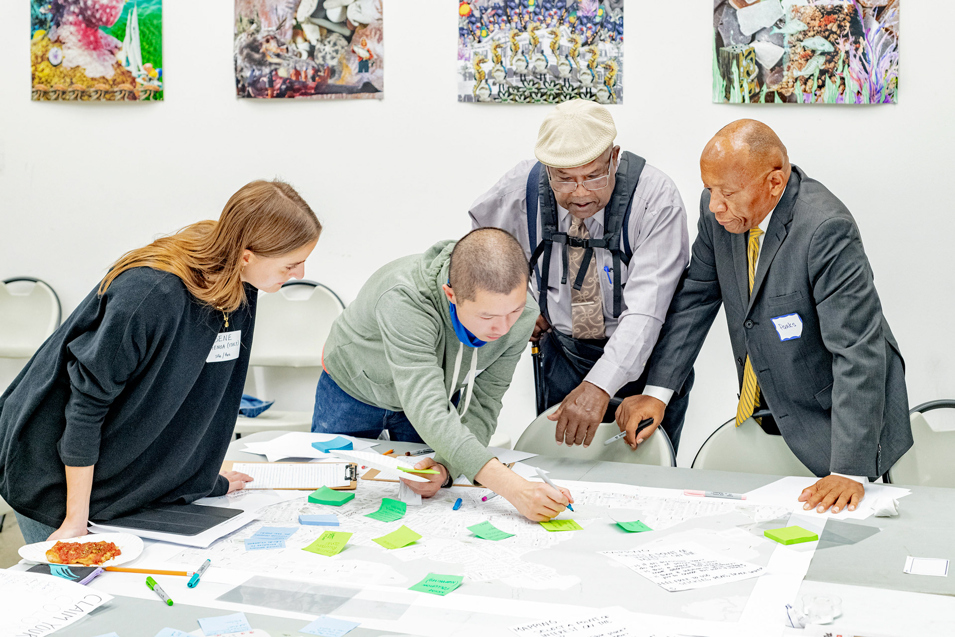
Community workshop at RISE
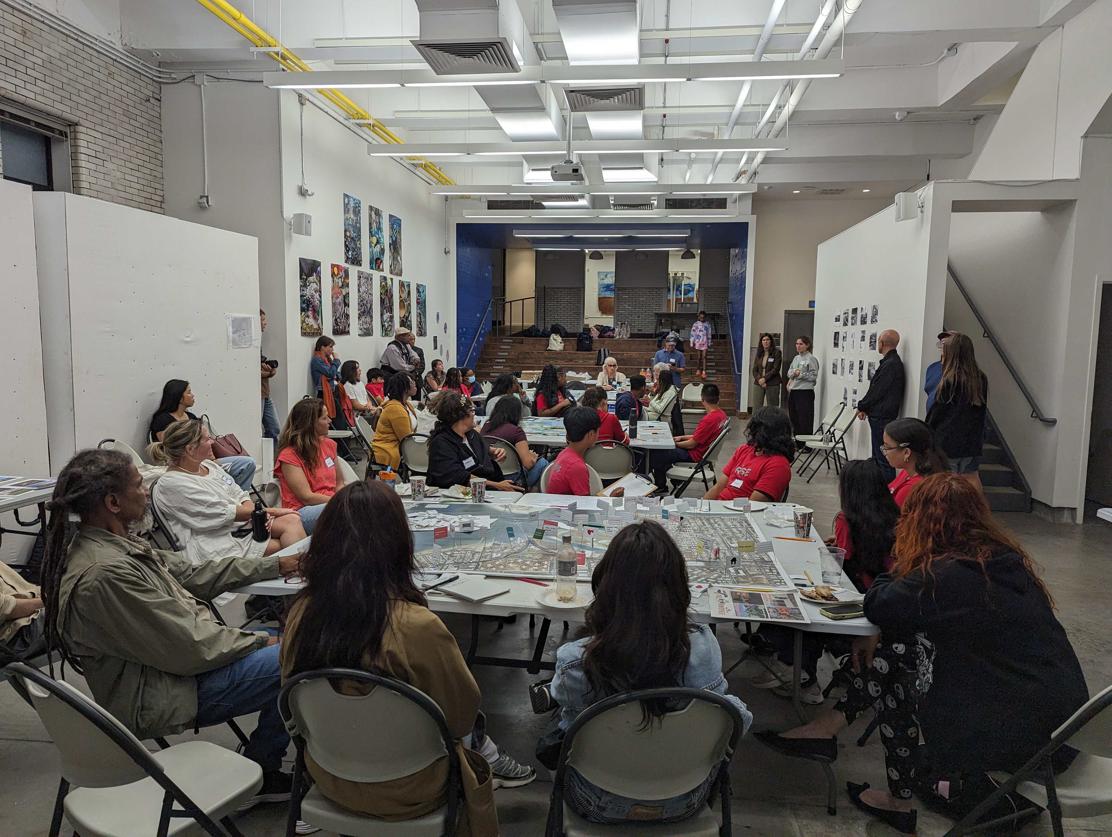
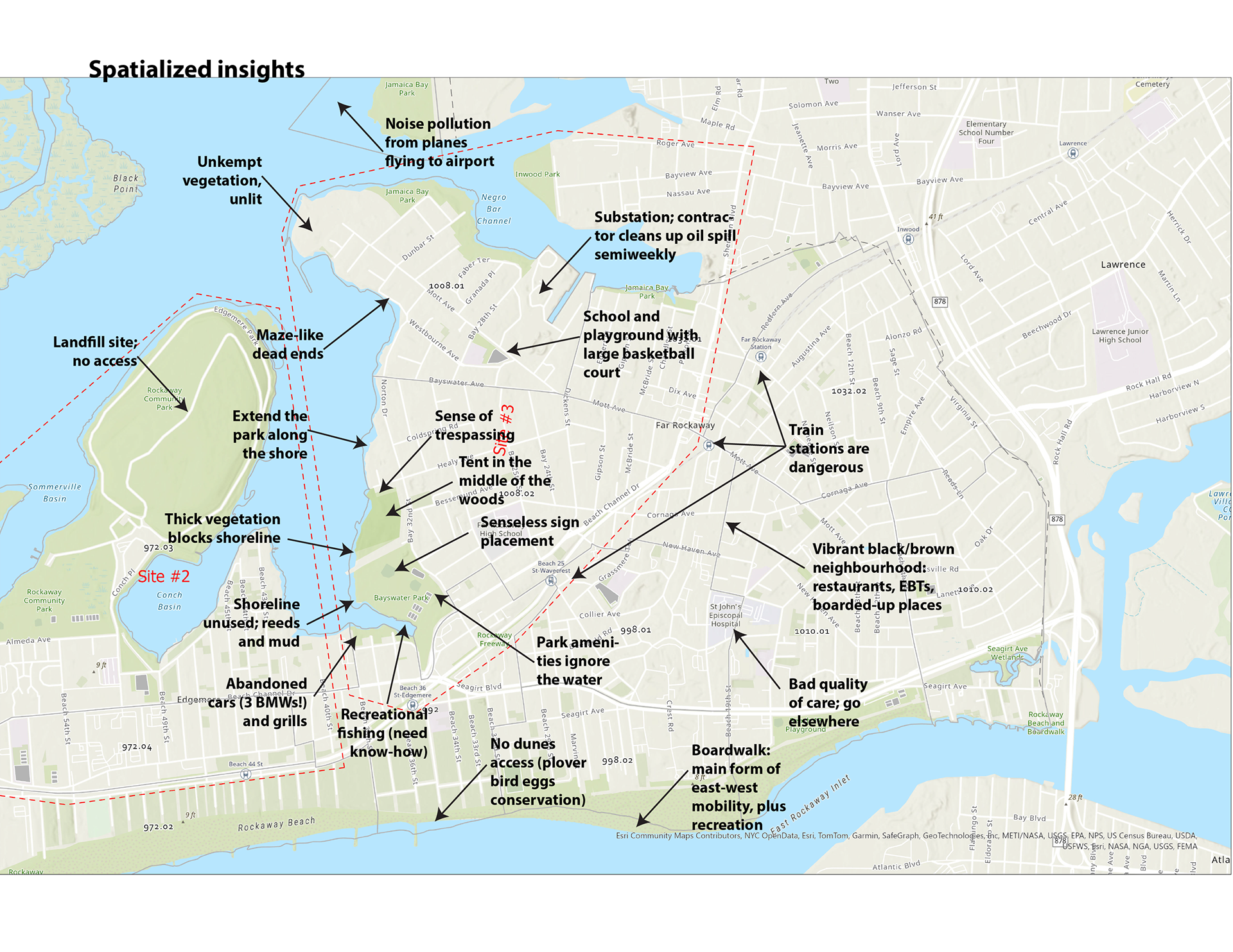
We prepared toolkits consisting of maps and annotation tools. On our first day in the Rockaways, we set up tables at the RISE office and (with the help of RISE youth) engaged local residents in a 90-minute co-design session to help them spatialize their aspirations for their neighbourhoods and the water. Where did they spend their time? How did they get there? What were they worried about? Safety and quality of life were on people's minds; sea level rise and gentrification, not so much.


Fieldwork in the Rockaways
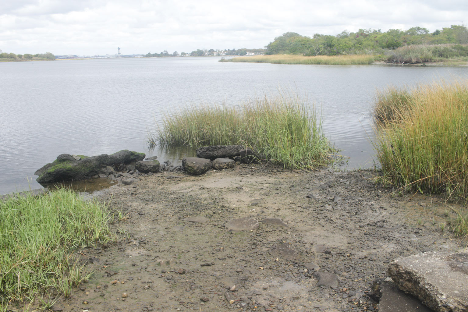
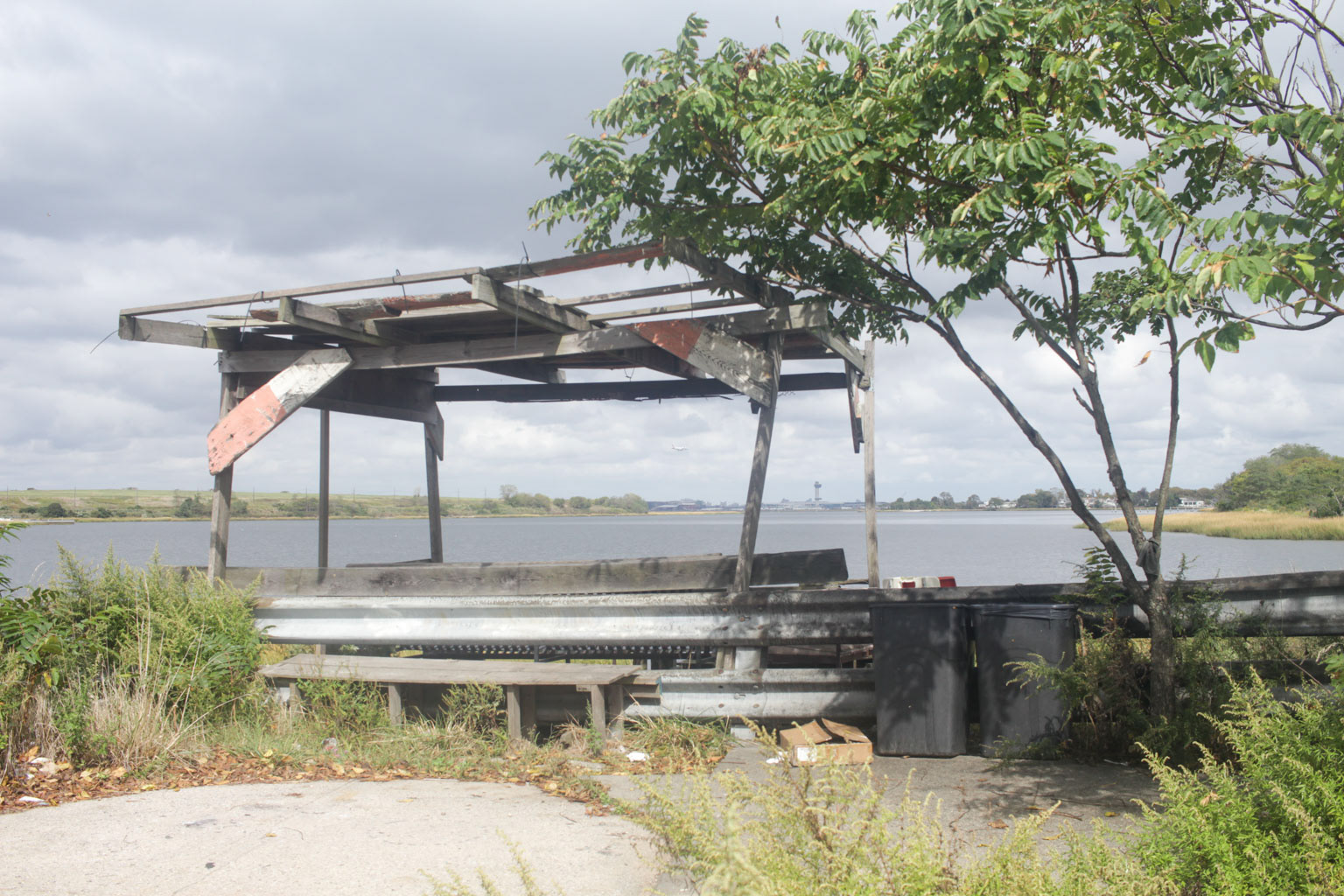
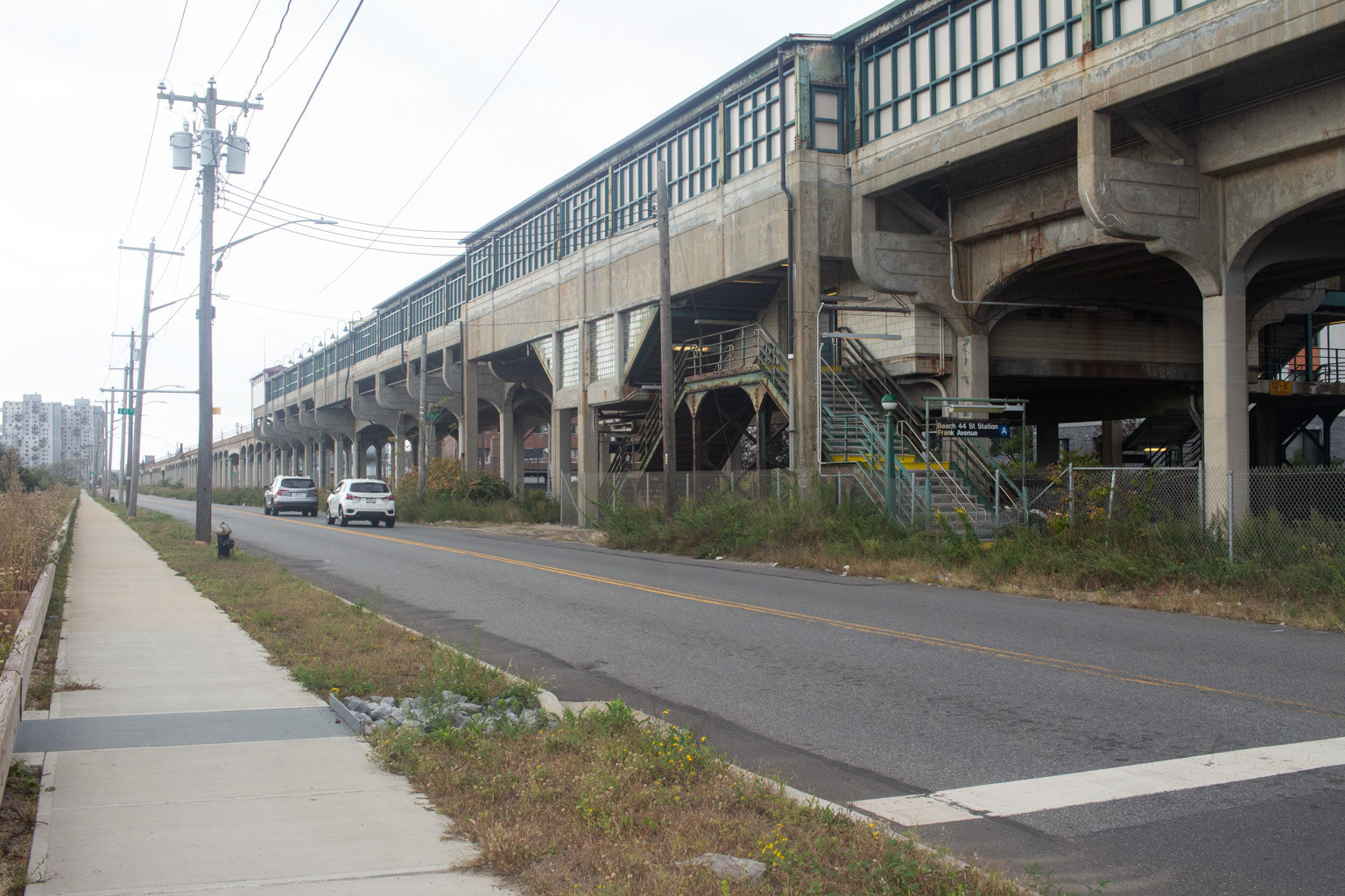
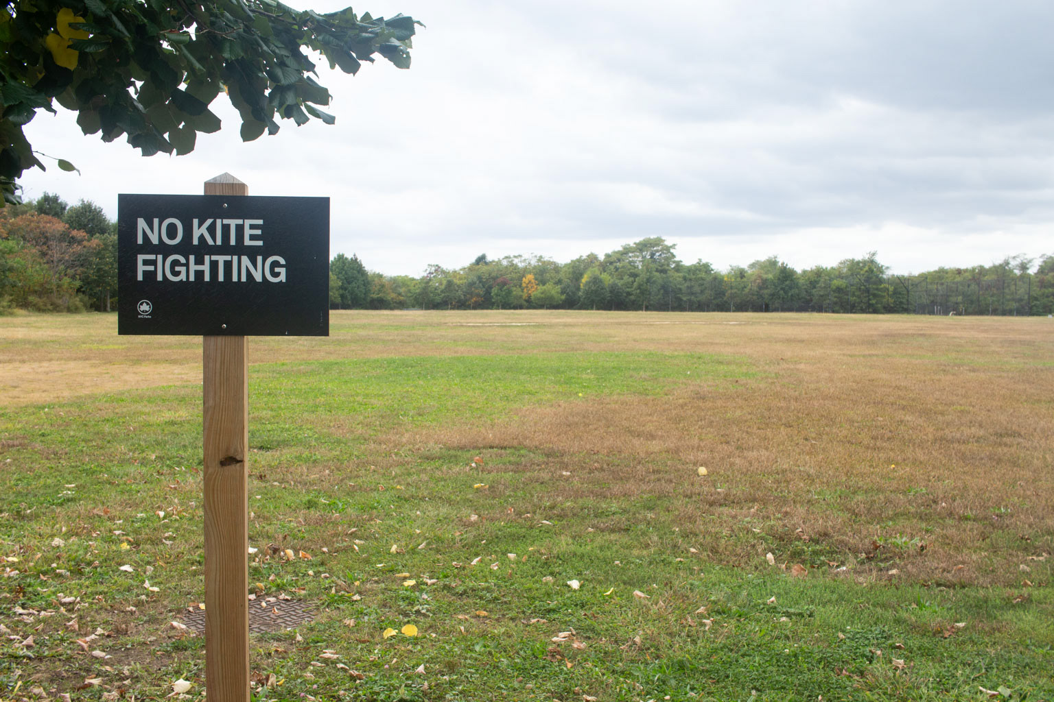
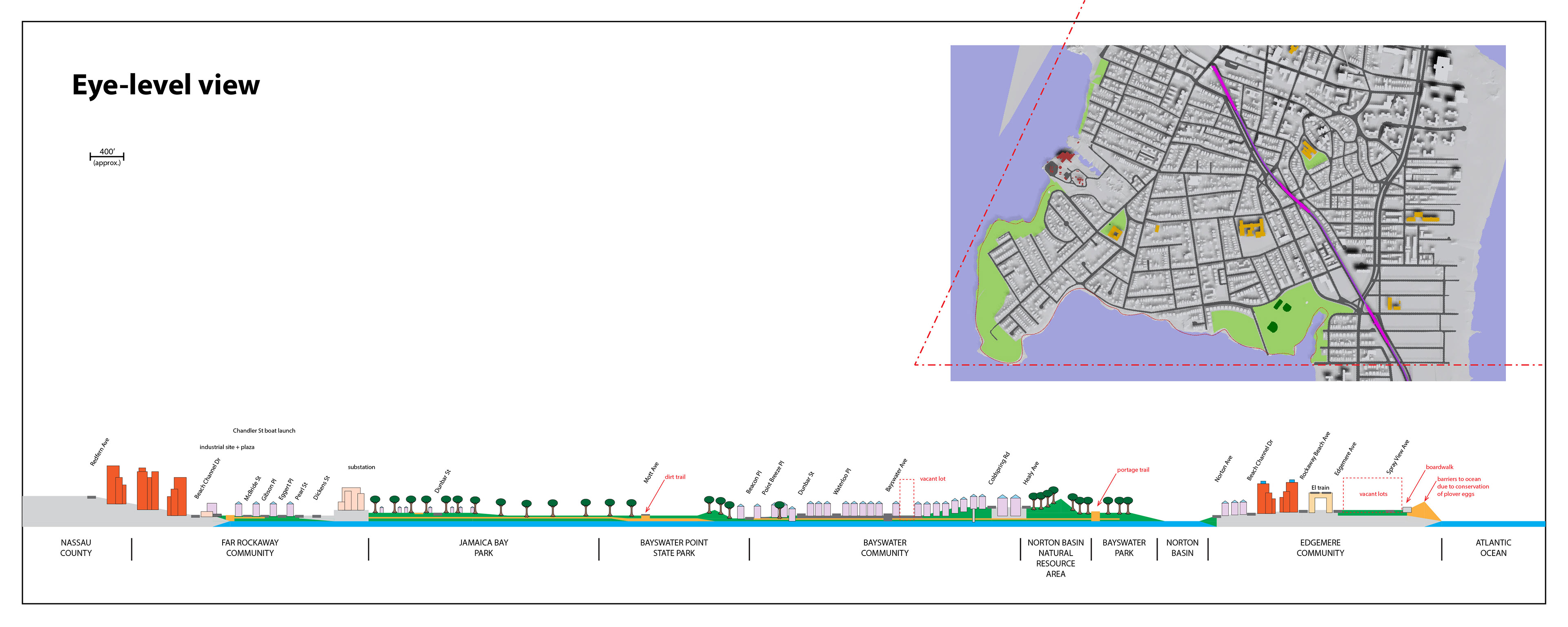
During our one-week site visit in October, the class also walked along and across the peninsula. We observed recurring patterns like negative signage ("No __!"), garbage, dead ends, unkempt vegetation, vacant lots, and noisy pollution from the El train, trucks, and airplanes on approach to JFK Airport across the Bay.





Mapping the site
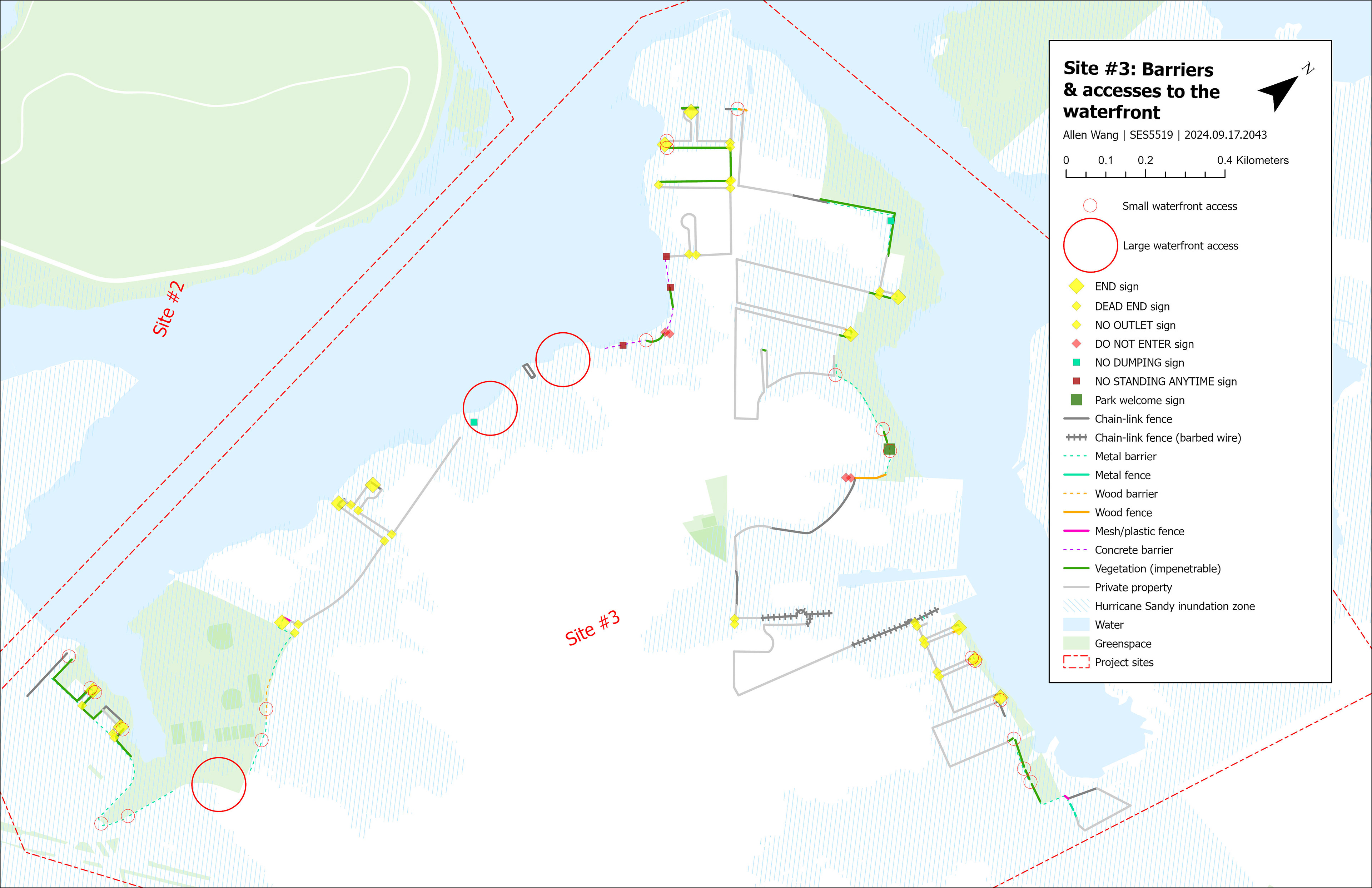
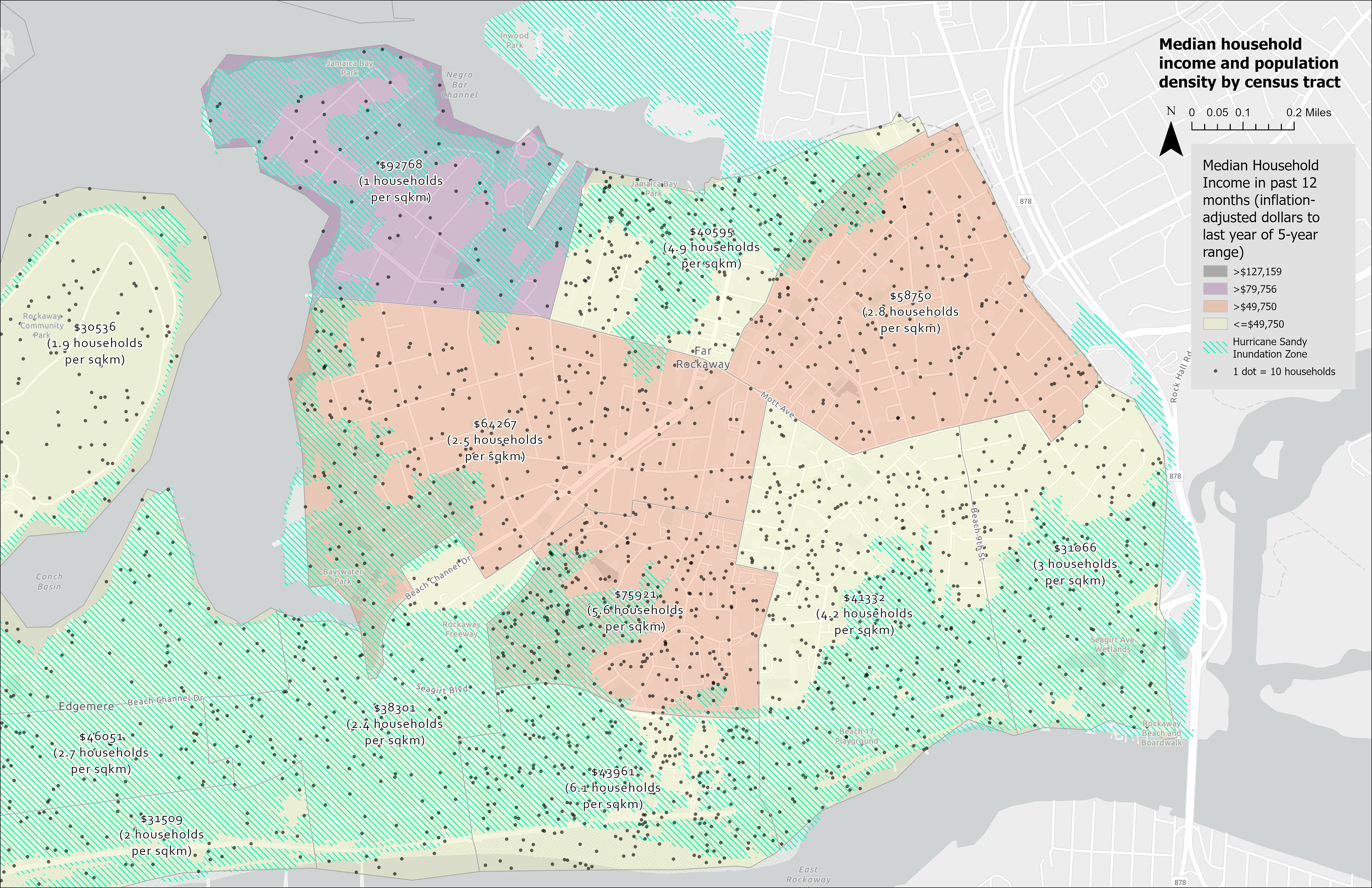
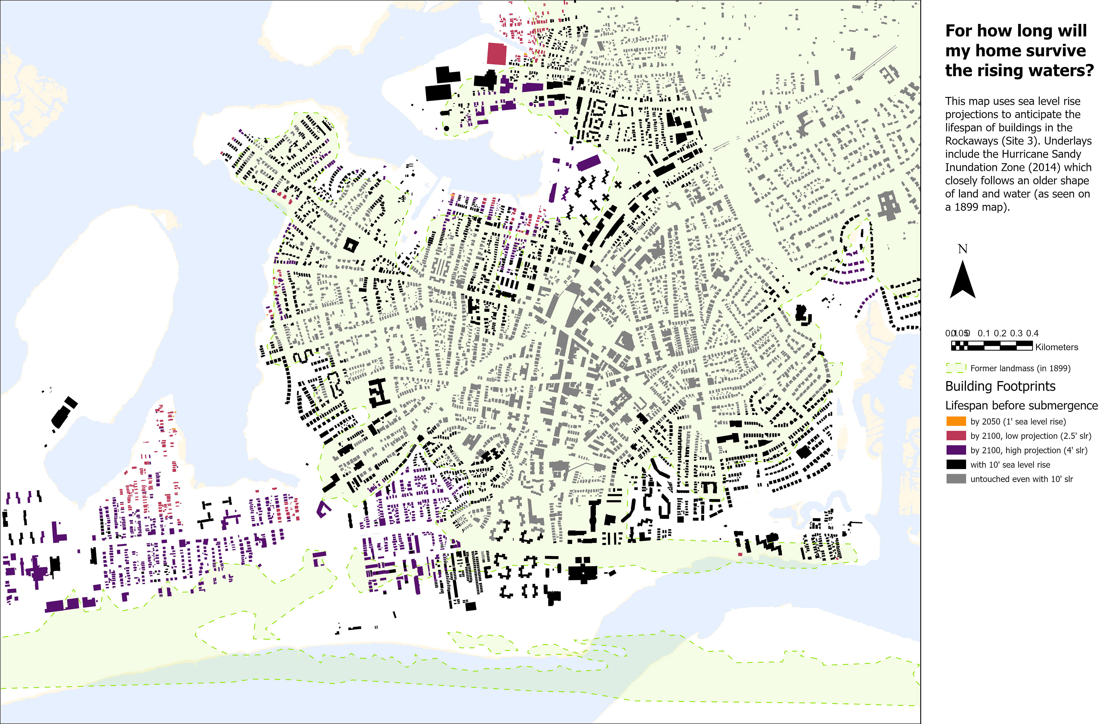
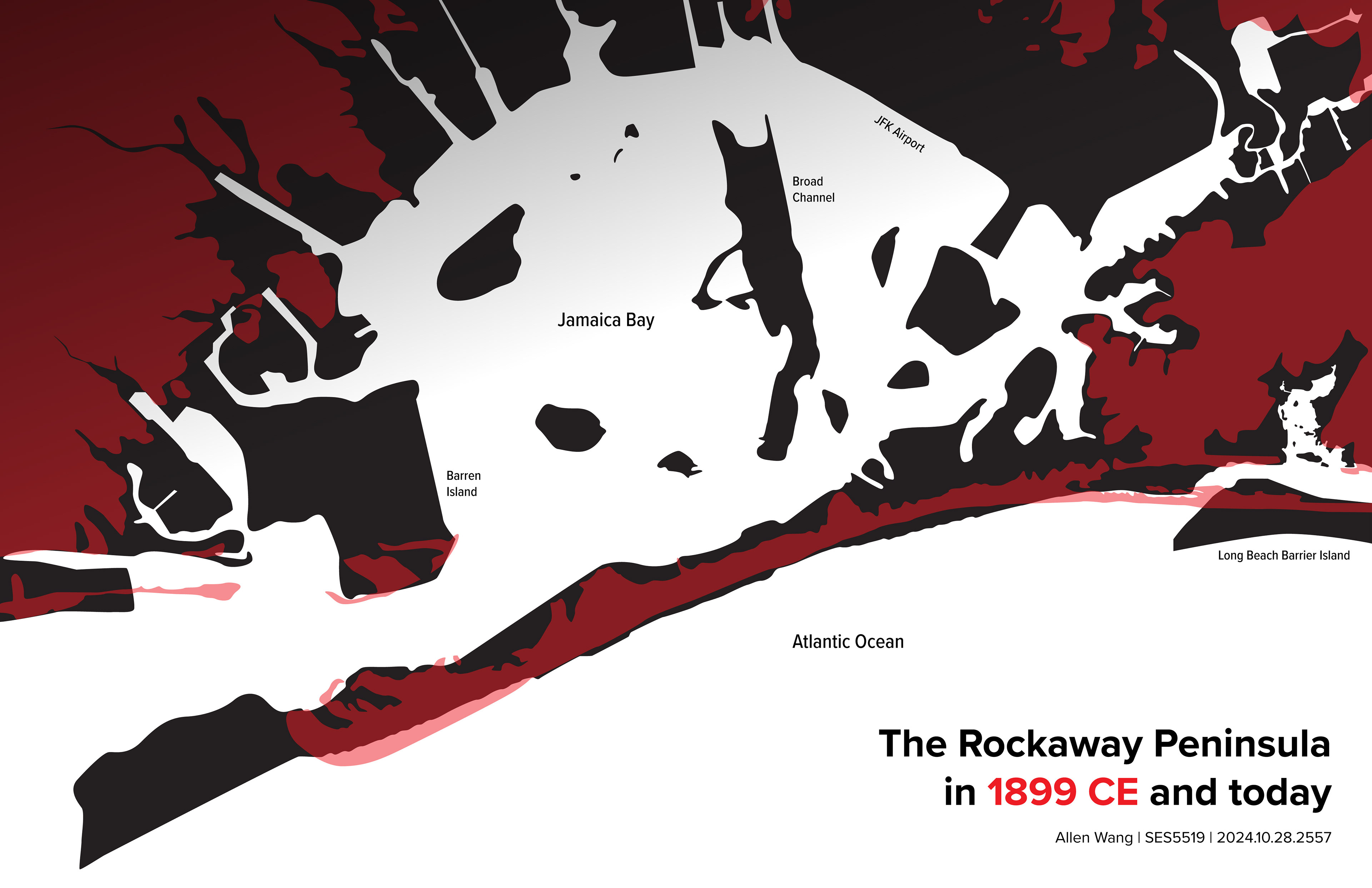
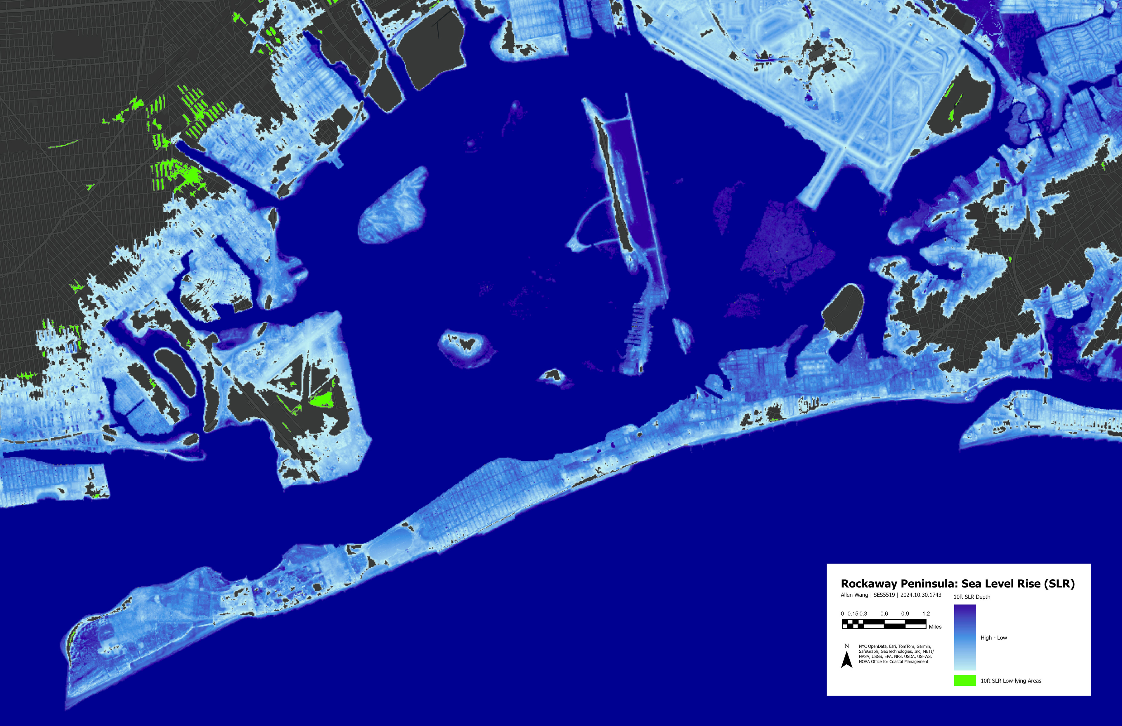
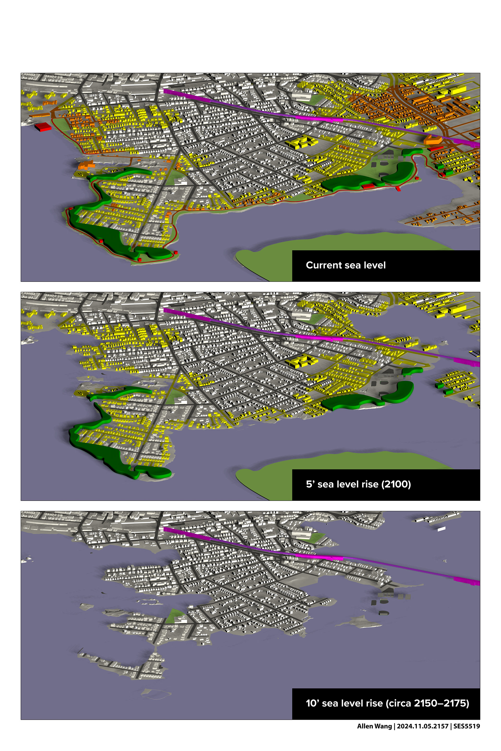
Maps helped me understand ecological and socioeconomic conditions in spatial terms. By overlaying historic maps and sea level rise projections onto buildings and parks, I anticipated how climate change is likely to affect residents in different places—and how this intersects with lower-income areas. Maps also helped me visualize insights from the workshop and fieldwork, including barriers to the waterfront.
Conceptual development
To produce the final public space plan and speculative spatial strategy, I iterated on renderings and diagrams in Rhino 3D and Adobe Illustrator to improve the clarity and fidelity of my ideas. In particular, an exercise in writing design code (inspired by Michael Sorkin's 1993 book Local Code) blossomed into a speculative constitution for the future Rockaway Archipelago community.
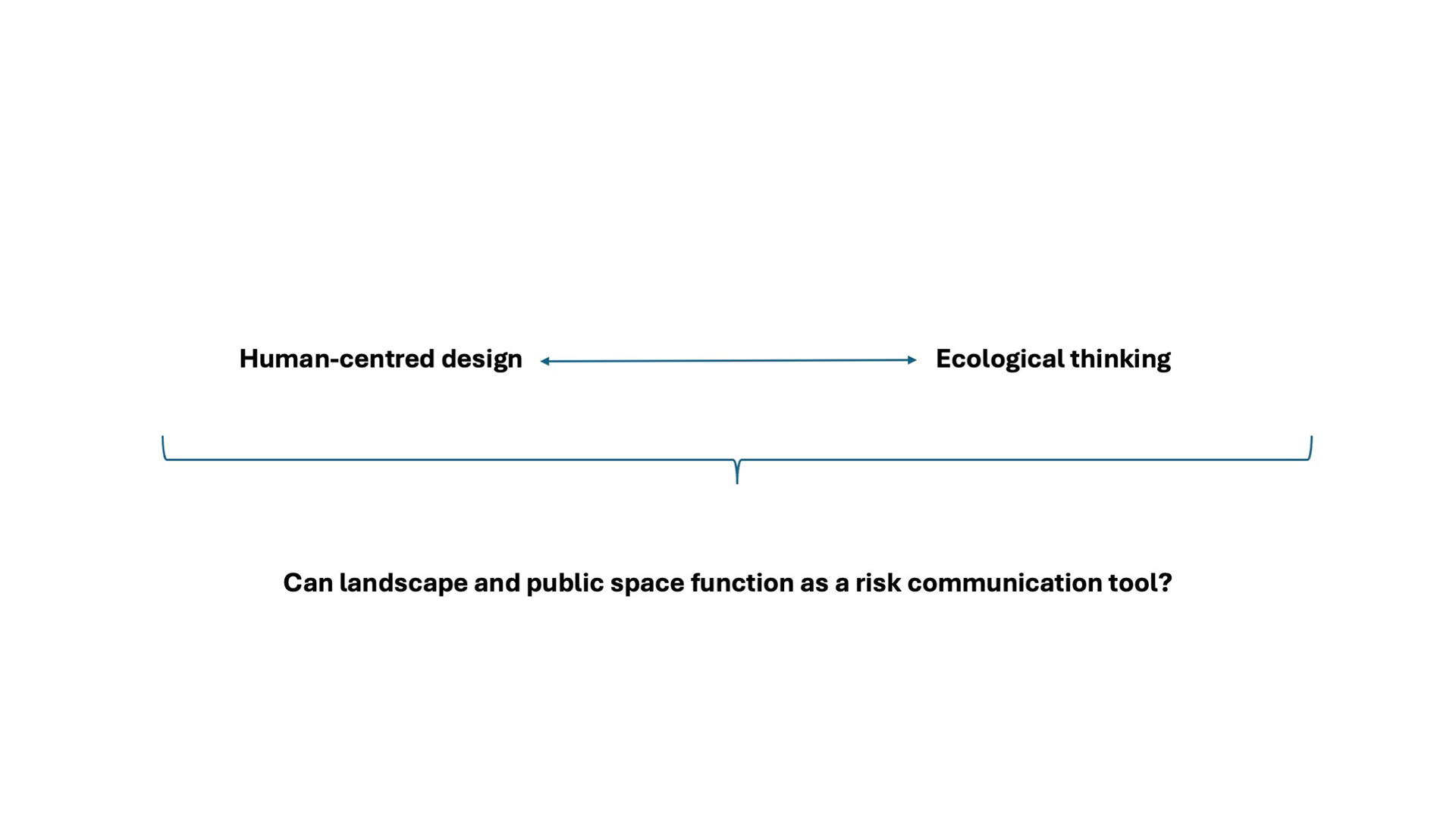

“No man is an island, entire of itself; every man is a piece of the continent, a part of the main. If a clod be washed away by the sea, Europe is the less, as well as if a promontory were, as well as if a manor of thy friend's or of thine own were: any man's death diminishes me, because I am involved in mankind, and therefore never send to know for whom the bell tolls; it tolls for thee.” —from “Meditation XVII,” John Donne